Legible Leeds
The city of Leeds has capitalised on a intensive period of development to improve the information it provides to locals and visitors. In particular, this investment in infrastructure has seen the city overhaul its wayfinding system and introduce Legible Leeds.
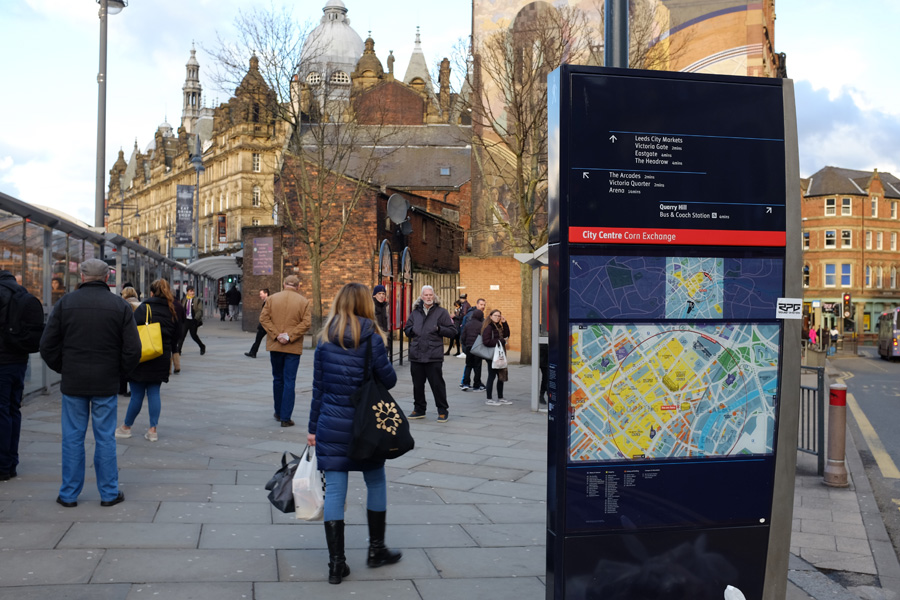
Before Legible Leeds, wayfinding for pedestrians in the city was in an unsatisfactory state. For example, different signs referred to at least four different names for the main railway station and three for the local tourist information office. These disparities were a symptom of Leeds lacking an integrated pedestrian information strategy, with no less than six separate, disjointed wayfinding systems in place. Moreover, the official city centre map appeared designed to serve vehicle access and car parking, rather than help pedestrians navigate.
Out of this situation, Legible Leeds was conceived and developed in 2009-10. Seeking to homogenise pedestrian signage within the city, it also had ambitions to promote Leeds as an accessible, attractive and active destination. Its core objectives included:
- Helping visitors to find their way on foot
- Highlighting specific destinations, and emphasising the variety of the city’s ‘offer’
- Increasing awareness of the waterfront and green spaces close to the city centre
- Aiding navigation in the city during a significant period of major development and change
In particular, these dramatic changes to the cityscape benefited pedestrian experience of the city by:
- Directing footfall towards exciting new development areas – Tower Works is a development of modern offices and studios built in an attractively refurbished gill-pin factory. It’s location, near the Granary Wharf, on the Leeds and Liverpool Canal is hidden behind Leeds Station. The thriving new hub, with seven restaurants, bars and cafés and 20 companies, benefits from wayfinding signs from the station.
- Helping large numbers of visitors find their way – The future vision for the HS2 (High Speed 2 rail link) Leeds Station will be located on the south side of the river, to join the current station over the river. The station currently serves 34m passengers per year and with the addition of the HS2 line this will increase considerably.
- Encouraging students to get around by walking – Leeds City College is currently building a new campus which will place new residents and visitors near the heart of the city.
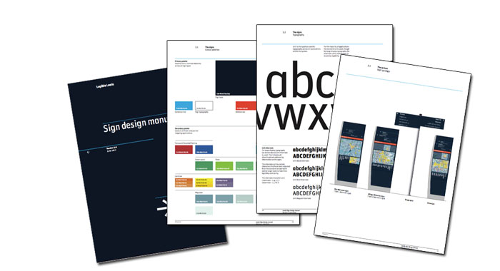
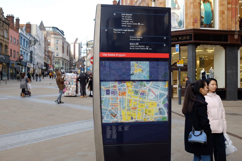
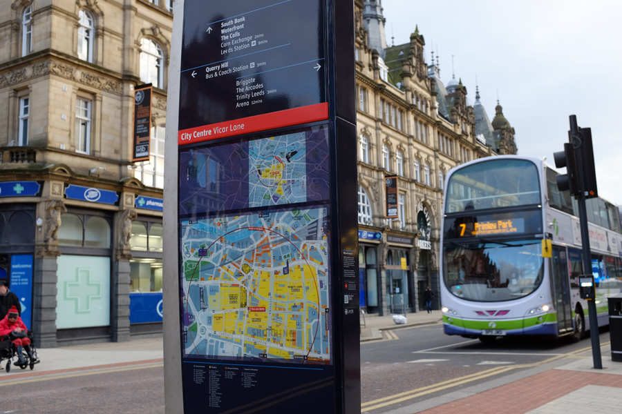
The Legible Leeds Sign design manual sets out every detail of a complex design
While the initial funding for Legible Leeds was provided by Leeds City Council and the regional development agency, the two subsequent expansion phases have been supported by development companies. Specifically, the opening of the Trinity and Victoria Gate commercial centres in 2013 and 2016 have led to more Legible Leeds signs being installed. These developments significantly change the ‘gravity’ of the city centre, and a contribution towards the refresh and expansion of the wayfinding system was agreed upon.
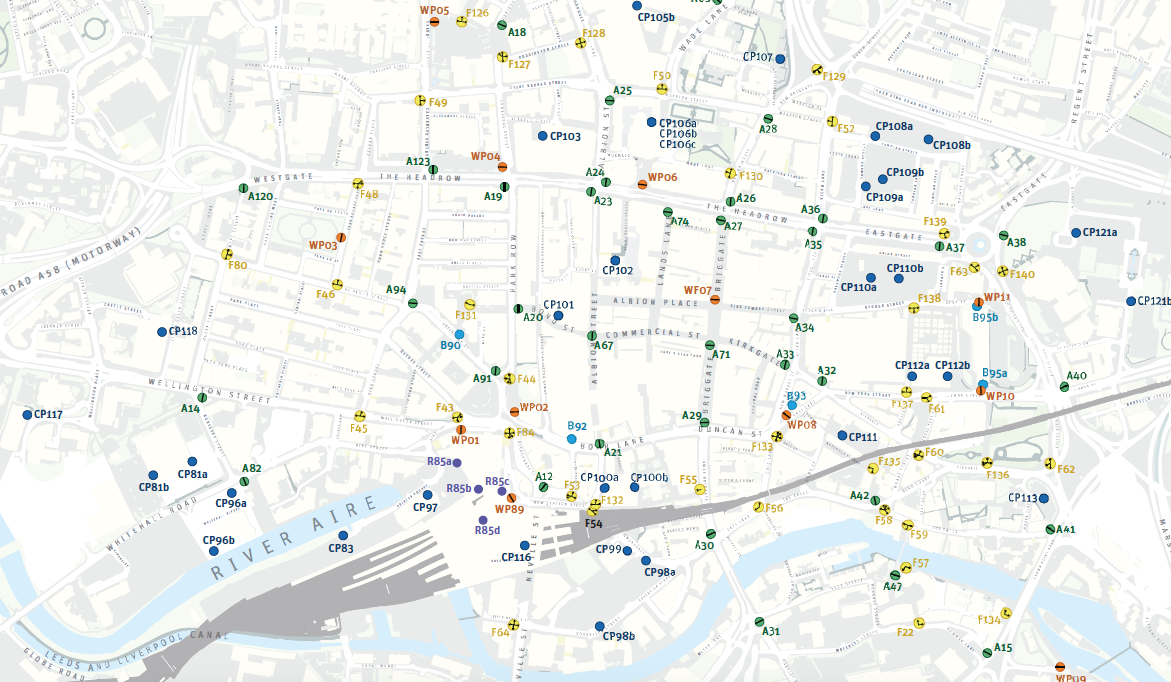
The positions of various types of wayfinding signs
Mark Durham, Economic Development Programme Leader of Leeds City Council, proudly points to Legible Leeds’ achievements:
- the large number of signs installed – currently 50, with a further 19 being added this year
- 100,000 printed maps distributed to compliment the on-street system
- Legible Leeds’ high standards of information maintained
Lessons learned from this project were many. The design specifications for the initial phase of Legible Leeds were ambitious, and included solar panels, LED backlighting, vitreous enamel surfaces and no visible fixings. Complications arose, however, and subsequent phases of signs were re-specced to leave out much of the ’nice to have’ features. This resulted in per-sign cost reductions of over 70%. Asked if lower cost signs also have an appearance of lower quality, Mark Durham reassuringly states that his belief that if the core function of each sign – its mapping and directional information – is of a high quality, then this will mitigate any effects of cheaper construction.
When asked for his top tips for any cities wishing to implement a system of their own, Mark Durham had the following recommendations:
- Wide-ranging stakeholder engagement at the outset is key. Everyone has a view on wayfinding and everyone has a view on place-naming. This is a time-consuming process, but consensus can be obtained and early support can be crucial in a system’s deployment.
- On-street wayfinding needn’t exist in a vacuum – harmonising your digital and printed mapping with your physical signage for look, feel and content increases user recognition and trust.
- Remember to look at channels outside of the transport domain, try to get examples of your mapping into visitor information points and hotel receptions.
- Invest in quality mapping and wayfinding design – this is the feature that underpins everything.
With an effective investment model, and strong support within both the private developer community and the city council, the Legible Leeds wayfinding system is well placed to develop and expand at the same time as the city it represents does.


