City of Toronto
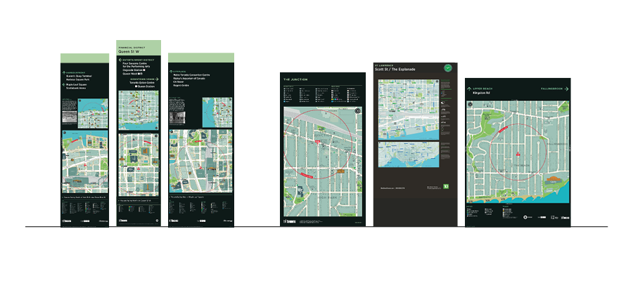
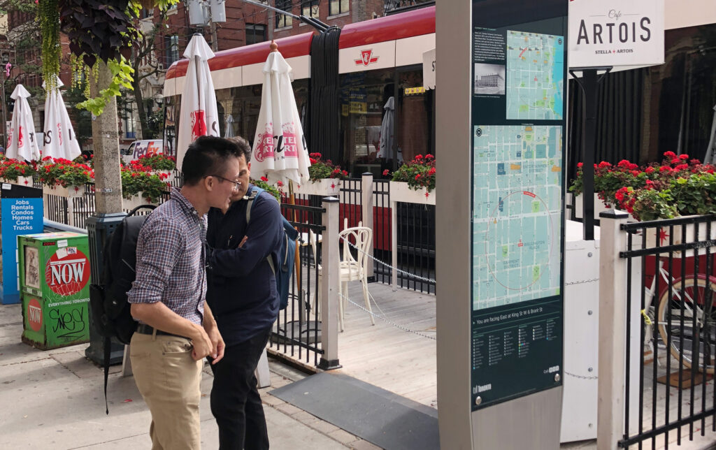
The Toronto 360 (TO360) Wayfinding project is a central component of the city’s ambition to make Toronto a more walkable, welcoming and understandable place for visitors and residents alike. Unified signage and mapping is communicated through touch points such as physical signage, handheld maps and digital media.
A thorough process of stakeholder consultation, prototyping and surveying have resulted in a number of themes tailored to the context of Toronto. These are: Consistency of content and presentation; Inclusivity catering to the needs of all users; Sustainability in considering full life cycle costing and adaptability to change; Transition connecting places and enabling people to move seamlessly between modes, systems and areas; and Local Identity celebrating and promoting the city and districts through community input and participation.
Pre and post Pilot evaluations showed strong benefits provided by the wayfinding system:
T-Kartor first built a ‘Primer’ database covering the entire 700 km2 city area. This provided a useful, generalised topography of the city verified exclusively through desktop research and analysis.
Then, detailed mapping was built up in specific areas planned to receive TO360 signs (currently at 156 km2). Our methodology at this stage uses a mix of stakeholder workshops and field surveys, resulting in a mapping system that is now not only accurate but also reflects the image Torontonians hold of their own city.
The Transportation Services Division of the City of Toronto has been conscious to make the TO360 Wayfinding ‘Map Asset’ useful to as many departments as possible. Variations on the pedestrian basemap have been created for Toronto’s Bike Share system, bus stops, the underground PATH system and Toronto parks & trails.
T-Kartor are currently carrying out a sidewalk inventory to make the basemap more useful to accessibility users.